Traffic Resources

This page includes useful traffic-related resources including public transit options, traffic counts, traffic calming information (ie. speed humps), and truck route information for over-sized and heavy vehicles.  For information about a topic, click on the subject title below that you’re interested in:

Valley Transit

Valley Transit is the primary public transportation organization for the Fox Cities area.  For up-to-date information, click here to visit the Valley Transit homepage.

The bus routes serving Neenah are linked below:
Route 10 – Neenah / Oshkosh (Operated by Go Transit)
Route 30 – Neenah / Menasha
Route 31 – East Neenah
Route 32 – West Neenah
Route 41 – West Fox Valley

Valley Transit II provides direct transportation for people with special needs.  For information on certification, fares, and trip reservations, click here to visit the Valley Transit II webpage.

Dial-A-Ride

The Dial-A-Ride service provides a direct transportation at reduced fares for residents of the cities of Neenah and Menasha. For information on certification, fares, and trip reservations, click here.

Per Section 16-5 of the City Code, all heavy or over-sized vehicles are restricted to the heavy vehicle routes shown on the Official Heavy Routes Map.  Click here to view the the map.  The definition of a heavy vehicle (per section 16-5) is any vehicle without pneumatic tires or with a weight in excess of 8,000 pounds, over 20 feet in length, or having a height of more than eight feet.  If you have any questions, feel free to contact the Public Works Department by email at publicworks@neenahwi.gov or by phone at 920-886-6240.

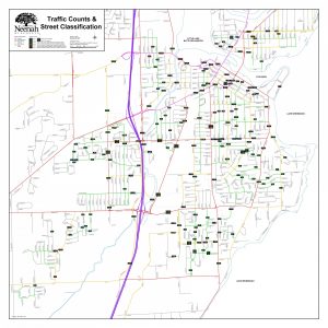
Each year, traffic counters are used to collect traffic volume data for various streets.  The counters are routinely placed on a mix of streets – from small neighborhood streets to major arterial streets – to best gauge traffic patterns from street-to-street and over time.  To view the most current traffic count information, click here to view the Traffic Counts & Street Classification map.

The numbers shown on the map represent average daily traffic, commonly referred to as ADT.  ADT just means how many vehicles were recorded on average per day.  The counts shown on the map are recorded over a typical one-week period when traffic volumes were not affected by holidays, construction, special events, and other influential factors that would otherwise alter the count.  Weekend data is also excluded from the ADT value shown on the map.  Traffic counts that have been taken during special occurrences outside a ‘typical week’ period are excluded from the map.  If you have any questions specific to a particular count, you may contact the traffic engineer by email at traffic@neenahwi.gov.

You can also obtain traffic count data on major streets from the Wisconsin Department of Transportation (WisDOT).  To view the WisDOT interactive traffic count map, click here.  The WisDOT counts show AADT, or annual average daily traffic.  The WisDOT AADT counts are based on a short-term traffic count, usually 48 hours, taken at the location.  The counts are then adjusted for the variation in traffic volume throughout the year.  For more information on the WisDOT traffic counts, click here to visit the WisDOT traffic counts page.

Commercial St & Winneconne Ave ICE Report (2023)

Commercial St/Winneconne Ave ICE Report Summary
Commercial St/Winneconne Ave ICE Full Report

Downtown Traffic  Study Phase II (2021)

Downtown Neenah Traffic Study Phase II – RFP
Downtown Neenah Traffic Study Phase II – Presentation
Downtown Neenah Traffic Study Phase II – Final Summary Report
Downtown Neenah Traffic Study Phase II – Project 1 (Network Management Plan) Technical Memo
Downtown Neenah Traffic Study Phase II – Project 2 (Main-Torrey Intersection Control Evaluation) Technical Memo
Downtown Neenah Traffic Study Phase II – Project 3 (Blue Parking Ramp) Technical Memo
Downtown Neenah Traffic Study Phase II – Project 4 (Hewitt Parking Ramp) Technical Memo
Downtown Neenah Traffic Study Phase II – Project 4 (Hewitt Parking Ramp) Signalized Engineering Study
Downtown Neenah Traffic Study Phase II – Project 5 (Main-GreenBay Roundabout Conceptual Layout) Technical Memo

Lakeshore Avenue Survey & Traffic Study (2020)

Lakeshore Avenue Multimodal Traffic Study Results
Lakeshore Avenue Reconstruction Alternatives Survey Results

Downtown Traffic Study Phase I (2018)

Downtown Neenah Traffic Study Phase I – Report
Downtown Neenah Traffic Study Phase I – Presentation

Downtown Commuter Traffic Survey (2016)

In late 2015/early 2016, the city surveyed employees within the
downtown area about routing to and from work.  This information is
intended to be used to identify issues with the current system and to
determine how to best make improvements.  The results of the survey are
available in the links below:

Downtown Traffic Survey – Summary & Results
Downtown Traffic Survey – Survey Forms
Downtown Traffic Survey – Open-Ended Responses

Downtown Parking Study (2015)

Downtown Parking Analysis and Management Plan

In late 2014 the City reinstated the Downtown Parking Task Force and
hired Carl Walker, Inc. to develop a parking management plan to improve
the parking experience in downtown Neenah..A key component of the plan
was to assess the state of parking in downtown Neenah and to recommend
improvements that better balances the needs of parking users and better
utilizes available infrastructure. Listed below are some of the primary
recommendations from the plan:

Parking Enforcement Recommendations:

  • Upgrade to computerized parking enforcement and ticket writing technology.
  • Explore the acquisition of License Plate Recognition (LPR) technology for enhanced parking enforcement capabilities.
  • Revise enforcement procedures and extend coverage.
  • Adopt a graduated fine structure that provides relief for first time offenders, but penalizes repeat and habitual offenders.

Parking Policy Recommendations:

  • Remove all remaining parking meters.
  • Develop a different approach to better manage the N. Church Street Ramp.
  • Consider changing posted time limits at prime on-street areas and in the primary customer lots.
  • Explore ways to get better utilization out of existing, under-utilized City permit lots.
  • Work with private lot owners on opening parking up for the general public.

Customer Service Enhancements:

  • Develop marketing and communications plan to better promote available parking options and policies.
  • Computerize the parking permit system.
  • Address user comfort and safety issues identified in the online survey.

Transportation Demand Management:

  • Develop a carpool program inside the N. Church Street Ramp and designate prime spaces at lower levels as carpool only.
  • Explore funding options to create a seasonal shuttle operation for remote employee permit lots.
  • Create better bike options downtown.

Report a Handicap Accessibility/Safety Problem

Handicaps can result in unexpected barriers to mobility and increased risk with hazards.  If you or someone you know is experiencing difficulty at a particular public location, feel free to contact the Public Works Department by email at publicworks@neenahwi.gov or by phone at 920-886-6240.

Warning Signs for Children with a Handicap

For residents with a child who is legally blind or deaf, the City will consider placement of warning signs to alert drivers traveling through neighborhood. To qualify, the child will need to be 12 years old or younger. To make a request for signs, fill out and submit the request form (below) to the Public Works Department. For additional questions, you may contact the Public Works Department by email at publicworks@neenahwi.gov or by phone at 920-886-6240.

Blind Child Area Sign Request Form
Deaf Child Area Sign Request Form